This is the fourth in a series of blog posts by Ben Sullender, Spatial Ecologist at Audubon Alaska. Throughout the series, Ben shares his experiences and reflections from his recent 14-day, 200-mile adventure in the Arctic National Wildlife Refuge. He was joined by Sarah Glaser. The two of them set out from Arctic Village, hiking and paddling their way to the Arctic Ocean.
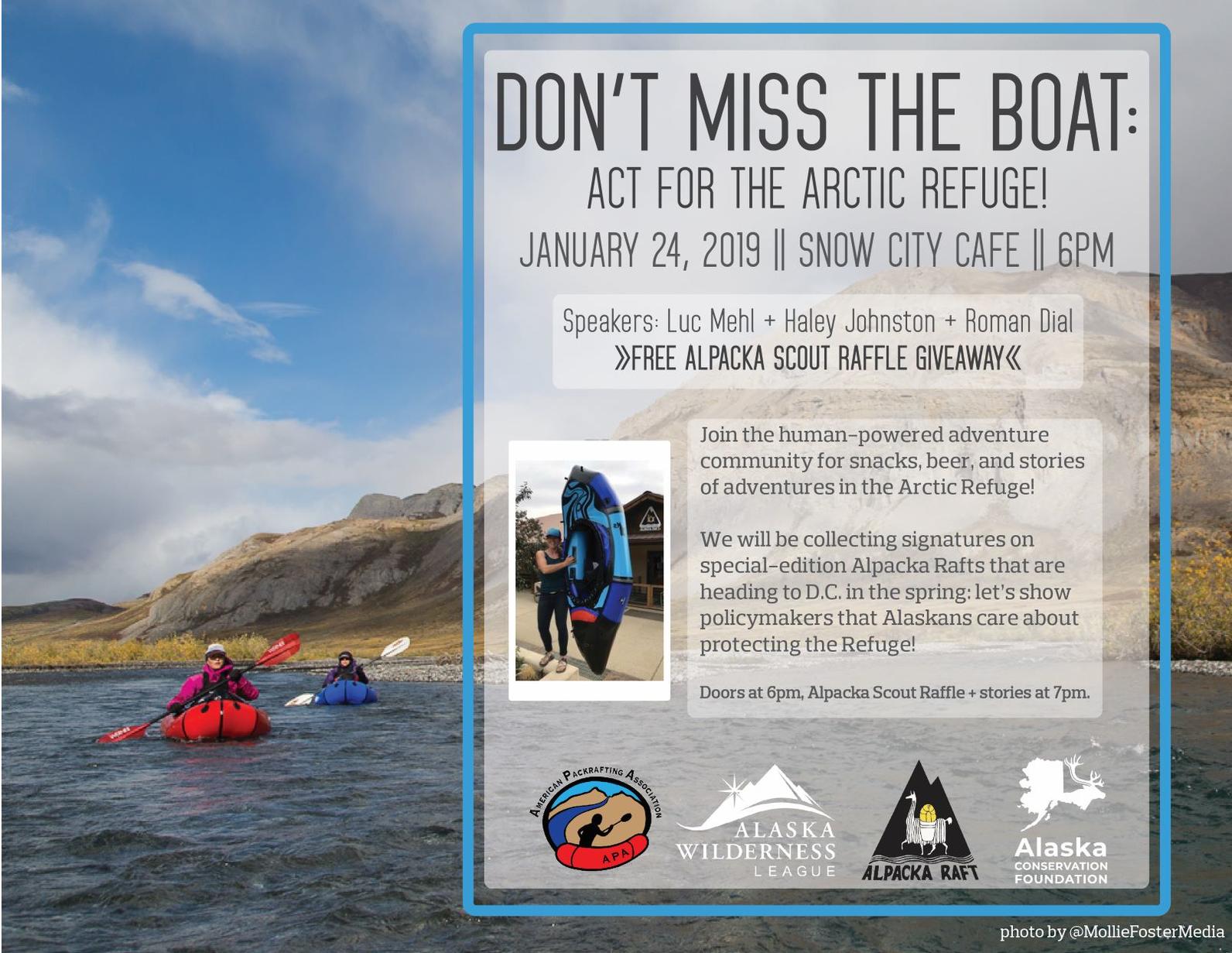
| SPECIAL EVENT: Hear more stories of packrafting adventures through the Arctic Refuge at "Don't Miss the Boat" on January 24 in Anchorage. See details at the bottom of this post. |
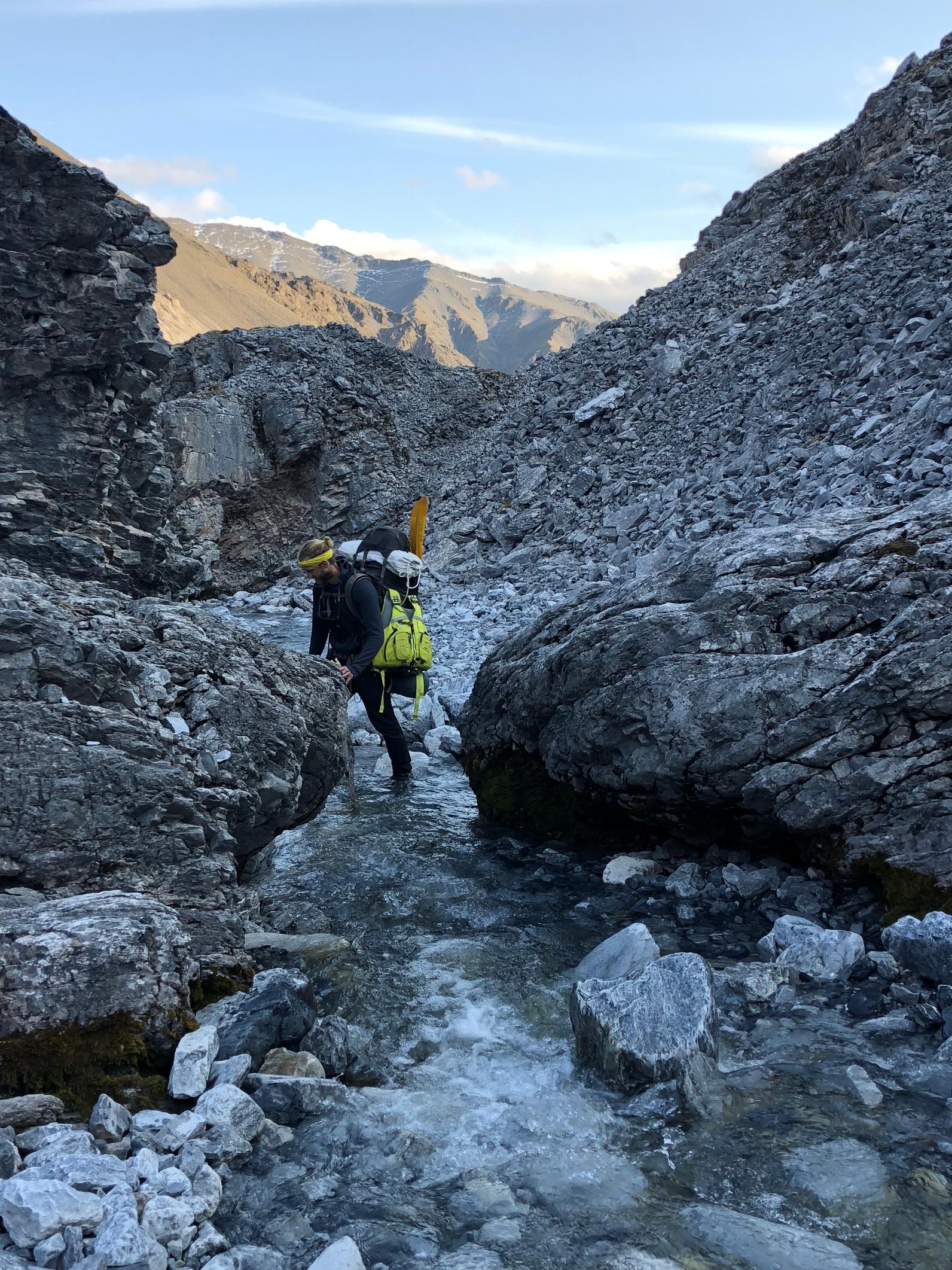
After six days and well over 60 miles on foot, our bags were noticeably lighter as we ate our way through our food and burned our way through our fuel supplies. Still, the going was tough. Easy travel along caribou trails now turned into arduous scrambles up rocky hillsides and across cascading streams. Our route was rapidly steepening as we approached the Arctic Continental Divide (the geographic line splitting the Brooks Range into rivers that flow to the Pacific Ocean and those that flow to the Arctic Ocean). This would be the high (elevation) point of our journey—as soon as we crested the Divide, we’d be traveling downhill the rest of the way to the Arctic Ocean. But, first we’d need to find a safe way up and over.
We had left behind the routes we’d researched when we unexpectedly began on the west, rather than east, bank of the East Fork Chandalar River. From the first day, we were inventing our route as we went and diverging further and further from the major hiking routes we had heard about. Faced with thousands of feet in elevation gain, and needing to thread a safe route through the mountains towering above, the unknown terrain was suddenly much more daunting.
Based on careful study of the topographic maps we brought, we decided to try to follow an unnamed creek to the base of the Arctic Divide, hoping it would cut a low-angle gradient through rocky headwalls and allow us to gain the Divide while avoiding technical climbing and minimizing exposure to big falls. Soon after starting up this creek, all signs of life rapidly retreated as we gained elevation. Trails of once-plentiful caribou droppings were nowhere to be found. Shrubs shrunk and withered before finally disappearing. Even the rocks were bare of lichens. All color drained from our surroundings. Vertical walls of steel-gray loomed above us and an unearthly clear stream slipped past underfoot before vanishing entirely.
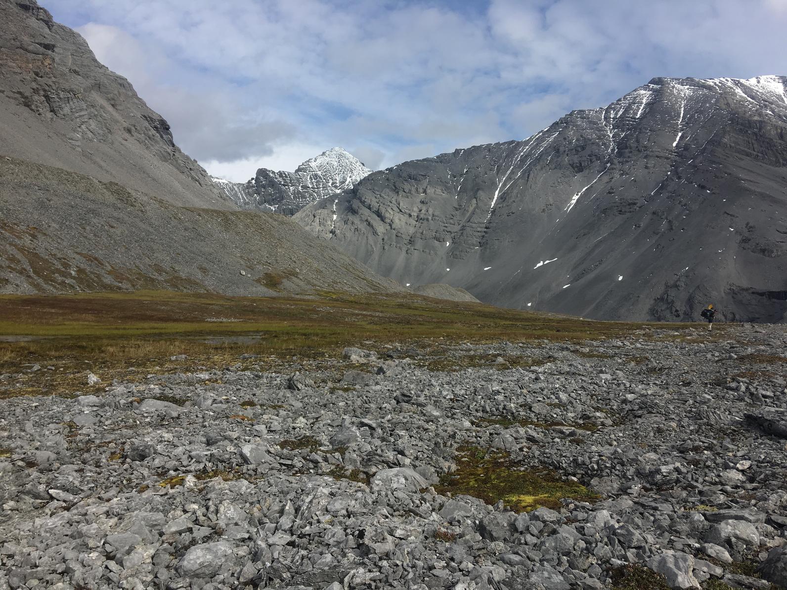
We rounded a final corner and found ourselves at the base of towering piles of scree that filled in the creek bed and closed off all options. We scrambled up the first plateau of scree, triggering landslides under our feet, like we were on a treadmill that dropped off beneath us for hundreds of feet. Beyond the top of this first plateau, another half-dozen crumbling terraces rose above and above those, sheer, snow-dusted cliffs.
We took our packs off and sat, gazing silently up at these beautiful but haunting walls. At that moment, both Sarah and I were overwhelmed, enveloped by the climax of a slowly growing sense of scale that we’d felt throughout our trip. We were totally immersed, completely lost in the enormity of the mountains around us, although they comprised one tiny, unknown valley. According to our map, this staggering mountain wall was a mere two or three topographic squiggles, nothing more. Yet the dark gray mountains that surrounded us were too immense and the bare terrain too committing for words. I’ll never forget that unnerving combination of scale, remoteness, and wildness.
As we experienced in this otherworldly valley, the Brooks Range is dynamic. Extreme Arctic conditions coupled with predominantly loose rocks result in a landscape that continually re-forms itself. Shortly before we began our trip, the North Slope was hit by a series of highly unusual earthquakes centered on the Sadlerochit Mountains, just south of the Arctic coastal plain. These earthquakes were unprecedented, over 50 times stronger than the largest previously recorded quake. Judging by the massive piles of unconsolidated scree, the earthquakes had dislodged a huge volume of loose rocks from mountainsides across the eastern Brooks Range, accelerating the natural disturbance cycles that created our unique surroundings.
We were likely the first humans to wander through the earthquake’s aftermath in this particular area, and the vastness of the Brooks Range means that there are many more of these inspiring yet untraveled corners. The Arctic National Wildlife Refuge was designated with wilderness as one of its three core values, along with wildlife and recreation. Wilderness means a lot of things to a lot of people, but core to the definition is a type of intangible value stemming from an area’s untrammeled, undeveloped, and natural character. In this valley, we’d happened upon a place where the sense of wilderness was simply overwhelming.
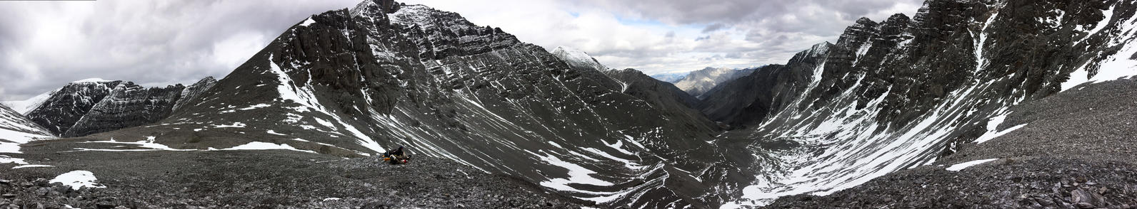
We slowly began thinking back to the journey ahead, and our goal of making it to the Arctic Ocean. As we stared up at the thousand feet remaining to climb, we considered our options and talked through possible scenarios. Neither of us were able to visualize a safe line through the cliffs. Even if we somehow made it to the top, the other side could end in a precipitous drop. We had hit a dead end. We made the difficult decision to retrace our steps and try another route rather than risk a high consequence scramble with unwieldy packs.
Fortunately, we’d compared notes with renowned Alaskan adventurers Luc Mehl and Sarah Histand. The previous summer, they’d completed an epic 21-day traverse of the Arctic Refuge (make sure to check out Luc’s excellent dance video of their trip!https://thingstolucat.com/arctic-refuge-traverse/). We knew that they safely made it over the Arctic Divide, and we’d marked down their route in our GPS. Spooked by our attempt at pioneering a new route over the Divide, we backtracked down the otherworldly valley and began a long detour to link into their virtual tracks.
Although we now had a known path to follow, I was still nervous, as this pass was described by those two super-fit backcountry experts as their “hardest day.” Indeed, Luc’s pass was a daunting final obstacle before Sarah and I could begin the long downhill voyage. We wound our way through beautiful cliffs, and slowly but surely climbed up alternating scree and snowfields. We made the Arctic Divide at around 6,500 feet above sea level, and carefully down-climbed a headwall above a rubble-covered glacier unmarked on our maps. We had finally made it to the North Slope!
Read all of the blog posts in this series:
Arctic Refuge Ramble: Ben’s Journey across the Arctic National Wildlife Refuge
Arctic Refuge Ramble: Arctic Village
Arctic Refuge Ramble: Into the Wilderness
Arctic Refuge Ramble: Across the Arctic Divide
Arctic Refuge Ramble: The Arctic Coastal Plain