Be sure to do Part 1 & Part 2 of the migration mapping activity before starting.
Did you know you can use Google Maps to figure out Longitude and Latitude? In the activity where we were Mapping Bird Migrations on Paper, we rounded the Longitude and Latitude to whole numbers (like 125 East), and did not worry about decimal places (like 125.894498 East), to make it easy to draw dots on paper.
But using the decimal points gives you more accurate Longitude and Latitude for where on the maps the birds were banded and recaptured. Let’s use more the more accurate numbers, and plug them into Google Maps to find exactly where these birds went.
For this activity, you will need to be signed into a Google account.
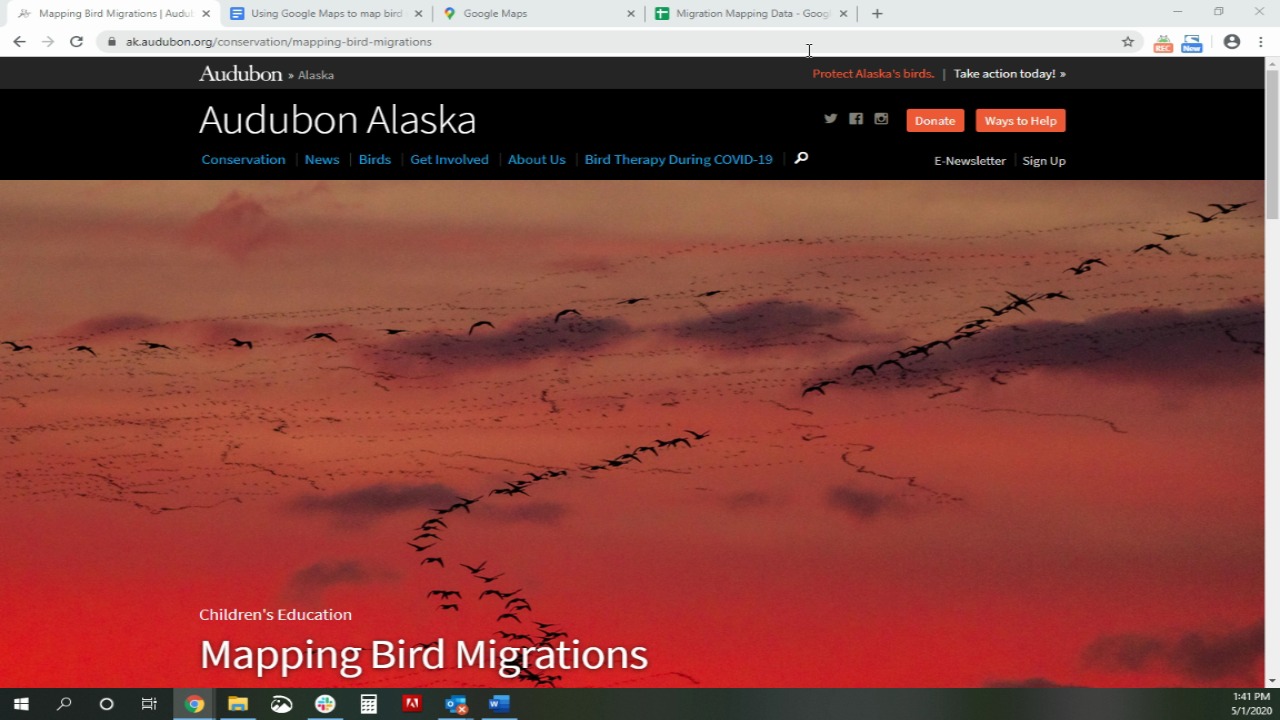
ACTIVITY: Mapping Bird Migrations with Google Maps
- You will need a Google account for this activity. Make sure you are signed in and go to Google Maps, or ask a parent or other adult to sign into their Google account and go to Google Maps.
- On your computer, open this Data Sheet in a new tab
- On your computer, also have Google Maps open in another tab
- Print out this Worksheet.
- Either follow along with the instructional video below or use these written Instructions.
How you can help, right now
Donate to Audubon
Help secure the future for birds at risk from climate change, habitat loss and other threats. Your support will power our science, education, advocacy and on-the-ground conservation efforts.

1% for the Planet
We are proud to be part of the 1% for the Planet network. If you own a business, please consider joining 1% for the Planet to support Audubon Alaska’s conservation efforts.